Overview
Geoscience Australia’s Semi-automated Morphological Mapping Tools
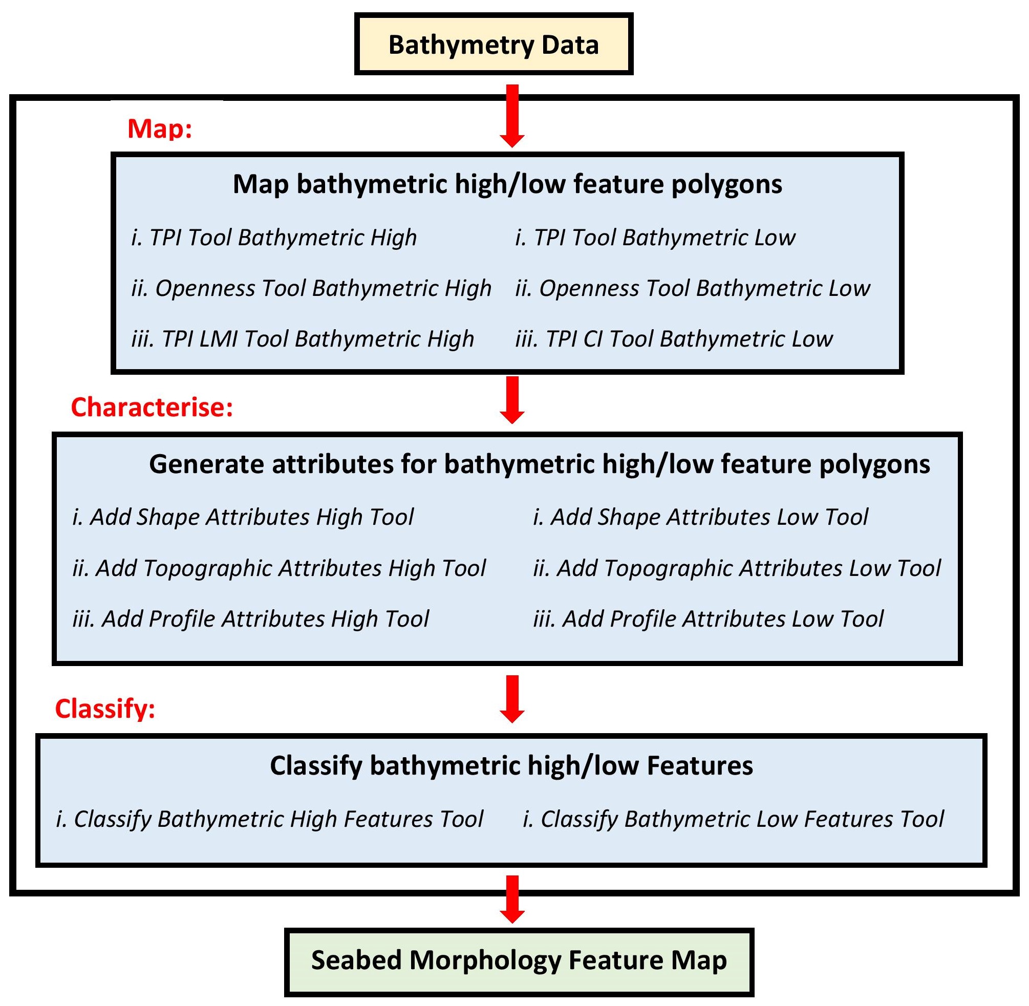
Seabed characterisation requires the measurement, description and classification of physical features on the seabed. A key first step in this process is the identification of morphological forms, as derived from bathymetry data. To facilitate rapid and consistent morphological mapping, Geoscience Australia has developed several semi-automated ArcGIS Python toolboxes that:
Generate polygons from bathymetry surfaces that represent bathymetric high and bathymetric low seabed features
Calculate metrics/attributes to describe the characteristics of the feature polygons
Classify individual polygons into one of the bathymetric high or low seabed morphological feature types
The toolboxes adopt the suite of terms as presented in the glossary of seabed morphology features defined by [Dove et al., 2020].
The detailed description of the GA-SaMMT and its applications to serveral real-world case studies are presented in [Huang et al., 2023].